St Catherine:
Capital is
Spanish Town
home of the
President/Ceo
of CaribLink .com
INTRODUCTION:
This profile of the parish of St. Catherine was commissioned by the Natural Resources Conservation Authority (NRCA) of the Ministry of the Environment and Housing, Government of Jamaica. It is jointly sponsored by the NRCA and the Parish Council of St. Catherine, and is funded under the ENACT (Environmental Action) Programme, a joint effort of the Government of Jamaica and the Government of Canada. Following is a quote from the official terms of reference stating the objectives of the Parish Profile:
The Parish Profile will be a compilation of information available on the social, economic and environmental conditions for the geographic area encompassed by the boundaries of the parish of St. Catherine. It will contain data on the following:
1. Physical setting and characteristics - including, but not limited to, geographical features, regional setting, climate, existing and planned physical infrastructure (e.g. transportation and power facilities), and reference to the sub-regional units that comprise the parish and how they are linked;
2. Social setting - including, but not limited to, population (size and demographic composition), settlement pattern, housing and health conditions, community organizations and available services;
3. Economic circumstances - including, but not limited to, current and proposed land uses, composition of existing economic activity and industries that have been identified as having potential for growth in the parish, labour force composition (should include reference to educational levels, and estimated personal income distribution);
4. Environmental setting - including, but not limited to, detailed bio-physical description of parish, identification of pollution issues (air, water and sanitation, solid and hazardous wastes, and their impact on natural resources).
BACKGROUND:
The need for the present study arose out of a conference hosted by the NRCA in collaboration with the Inter-American Development Bank (IDB) at the end of January, 1995(1) . This conference was aimed at "... the discussion of issues impinging on the very complex and varied environment in the parish of St. Catherine"(2) and included "... representatives from a wide cross-section of interest groups ... bringing to the fore-front the perspective of the sector or community ... to set in motion a process that begins to build bridges between sectors interested in solving environmental problems and promoting economic development"(3) .
CHAPTER 1: AN INTRODUCTION
BRIEF The parish of St. Catherine is located in the County of Middlesex on the south coast of Jamaica between the parishes of St. Andrew to the east, Clarendon to the west, and St. Ann and St. Mary to the north. The intersection of Latitude 18o00”N and Longitude 77o00”W is just west of Spanish Town, the parish capital. There is also a significant expanse of territorial sea lapping the southern borders, but the precise boundaries have not been defined.
Of Jamaica’s fourteen parishes, St. Catherine is the fourth largest (after St. Ann, St. Elizabeth and Clarendon), with an area of 1,192.33 km2 (460.4 sq. miles) or 10.8% of Jamaica’s land area[4]. However, it is the parish with the longest coastline – 112.94 km2 (70.18 miles) or 12.7% of Jamaica’s perimeter(5]. Most of St. Catherine’s coastline is inaccessible and fringes the dry limestone forests of the Port Henderson Hills and the Hellshire Hills, and is either mangrove forest or rocky shore. Although it has the fewest fishing beaches of all the parishes, it has Jamaica’s largest fishing beach (Old Harbour Bay). The long white sand beaches at Hellshire are very popular to bathers and sun-lovers from Kingston, St. Andrew and St. Catherine.
(1) NRCA/IDB Round Table on the Environment. Twickenham Park, Spanish Town, St. Catherine, January 31, 1995
(2) Correspondence to prospective participants, January 18, 1995
(3) IBID
(4) GOJ, STATIN. Pocketbook of Statistics, Jamaica 1994. STATIN:Kingston 1994. Table 4, Page 17
(5) GOJ, STATIN.Statistical lYearbook of Jamaica, 1981. STATIN:Kingston 1983. Table 3, Page 3
Church of England Fort Henderson Healthshire Hills Parade Square Rio Cobre The first Rastafarian settlement
AN INTRODUCTION TO THE PARISH OF ST. CATHERINE
(The following information has been taken from a document called “Second Draft: A Profile of the Parish of St. Catherine prepared for the Natural Resources Conservation Authority and the St. Catherine Parish Council by the Caribbean Coastal Area Management Foundation. June 1999)
BRIEF HISTORY
CHAPTER 1.1 Brief History
Pre-Columbus
Before the arrival of the Spanish, the area now known as the parish of St. Catherine was inhabited by the Taino people (also known as the Arawaks), who were fishers and farmers. The record of their civilization can be found in the soil and caves of St. Catherine. They had several settlements, including villages at Ferry, the Hellshire Hills, Dover, Mt. Rosser, Mahoe Ridge, Marlie Mount, Colbeck, Mountain River, Byndloss Mountain, Worthy Park, Naggo Head, the Great Salt Pond, Great Goat Island, Two Sisters Cave, Port Henderson Hill, Rodney House, Wreck Point, Old Harbour Bay, and at White Marl. At the latter of these locations, radio-carbon dating of samples has indicated that the area was inhabited about 900 A.D. Taino stone tools found at Two Sisters Cave (which is now closed to the public) and elsewhere in St. Catherine, are surrounded by much speculation as to their origin and workmanship. Most evidence indicates that river stones were sharpened and polished by the Tainos in a time consuming process involving basic raw materials.
The Arrival of the Spaniards
On August 18, 1494, Christopher Columbus on his second voyage was beset by storms on the south coast of Jamaica. He spent a day off the coast of St. Catherine in Portland Bight (probably in Galleon Harbour) where he found many Taino villages and, by his own words, the most civilized people he had met on his travels. He named the bay Bahia de las Vacas because of the many manatees (sea cows) he found there. Few are seen today.
When the first Spanish colonists arrived in Jamaica in 1510, they established Sevilla Nueva (New Seville) in what is now St. Ann as Jamaica’s first capital; but the area was swampy and unhealthy, and in order to locate a more suitable site for the capital of this new Spanish possession, Pedro de Mazuelo, the Island Treasurer, spearheaded a search party. While moving south across the island, he spotted a large plain on the banks of a river (later to be called the Rio Cobre) inhabited by the Tainos who had cleared and cultivated some of the wide, fertile area. Mazuelo pronounced the area an ideal setting for the new capital, and he encouraged colonists from New Seville to settle there. He set things in motion by constructing a sugar mill in the area, and by writing to the King of Spain, commending the site as suitable for a new capital. Eventually the new capital was named Villa de la Vega (Town on the Plain), later Santiago (or St. Jago) de la Vega (St. James on the Plain) and established in 1523 near to Mazuelo’s Mill. St. James is the patron saint of Spain, and many towns and cities in the New World bear that name. The first St. James Cathedral (Roman Catholic) was built in 1525 on the site of the earlier Chapel of the Red Cross. When the English captured Jamaica, they destroyed that building and built St. James Church (Anglican), which was demolished by an earthquake in 1712 and rebuilt in 1714. In 1843 the church became a Cathedral again, and is still the seat of the Anglican Bishop of Jamaica. The Parish of St. Catherine – much smaller than today’s parish – was formed by the Spanish in 1534 (named for St. Catherine of Sienna). Jamaica’s first Spanish Governor, Juan de Esquivel, established a shipyard at Esquivel (now Old Harbour Bay), where harbour facilities for the capital were located. Other Spanish settlements in St. Catherine were Cayagua (about six miles to the east of the capital where Passage Fort now lies), and Guanaboa which today still bears that name.
Under the Spanish, the flat lands near Esquivel and at Guanaboa were used as hatos or cattle ranches. At this time, Jamaica was little more than a supply depot for passing ships (Jamaica was on the route between Cartagena and Havana). A Carmelite missionary, Antonio Vasques de Espinosa, writing around 1628 says that St. Jago de la Vega was “marvellously attractive … very well built and laid out”. In 1643, an unwelcome English visitor, Captain William Jackson, plundered
St. Jago de la Vega, and thought it a fair town, consisting of four or five hundred houses, five or six stately churches or chapels, and one monastery of Franciscan friars. The people of the town had had warning of Jackson’s approach, and moved to the hills with most of their valuables. The place was held to ransom nevertheless. Meanwhile, the invaders enjoyed a pleasing change from ship food and, we are told, feasted on “Hoggs, Henns and other good provision”[6]. His men liked the island so well that many deserted, and had to be left behind.
One of the special regular feasts celebrated by the Spanish was that of St. John. On that day, the people went out to Cayo de Palominos (Pigeon Island) off Old Harbour Bay to celebrate. At that time of year, the cay was so full of young doves that those who went not only cooked and ate as many as they could, but loaded their boats with young birds for the return journey.
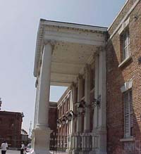
King's House
The English Capture Jamaica
The English expeditionary force sent by Oliver Cromwell to capture Spanish possessions in the Caribbean (called his “Western Design”) landed at Caguaya in 1655 with 6,000 troops, and after firing a few shots, captured the small fort there. They sent harsh terms of surrender, including that those who wished could leave the island, and waited for the reply. This gave the Spanish time to let their cattle loose, free their slaves and take to the hills with their valuables.
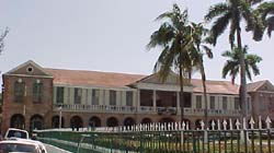
Parish Council Offices
When the invading force marched into St. Jago de la Vega it was largely empty and bare of booty; in anger and disappointment, they destroyed much of the town, burning the churches and melting the bells for shot. When it became clear that the invading force was here to stay, the Spanish fled to Cuba. The freed slaves – later to be called the Maroons – harried the English, and were settled mostly on the hills of St. John, still called Juan de Bolas Mountain after one of their chiefs (his real name was Juan Lubolo). Maroon settlements were also established in the Hellshire Hills.
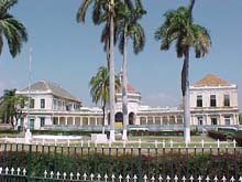
looking North at the Rodney Memorial
After the English conquest in 1655, St. Jago de la Vega became known as “Spanish Town”, and continued as the capital. The Audencia – the Hall of Audience with the Spanish Governor – was pulled down in 1761 to make way for the “King’s House”, the official residence of the British Governor. It was located on one side of a square (called the “Parade Square”), which in addition contained the House of Assembly (now the Parish Council Offices), the Supreme Court (which became the Spanish Town Courthouse) and the Record Office. Many distinguished visitors were received at King’s House in Spanish Town, including Admiral Rodney (who defeated the French in the Battle of the Saints), Admiral Horatio Nelson (who defeated the French in the Battle of Waterloo) and Captain William Bligh (of Mutiny on the Bounty fame, who brought the breadfruit and other exotics to Jamaica from the Pacific). At the northern section of the Parade Square is a marble statue of Rodney by John Bacon built on the site of the old Spanish Tavern, and two large bronze guns captured by the admiral in 1782 from the French Fleet under Comte de Grasse. Unfortunately, the old King’s House burnt down in 1925, and part of it has been used as a folk museum since 1961. The Supreme Court building burnt down in March 1986.
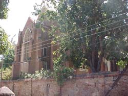
The Church of England (Anglican) established itself quite early on, and parish churches were built shortly after the 1665 conquest. The Parish Church of St. Thomas-ye-Vale in Bog Walk was built in 1675; construction of the St. Dorothy’s Parish Church near Old Harbour began in 1682. St. John’s Parish Church in Guanaboa Vale was built in 1699. The Anglican Cathedral of St. Jago de la Vega was built in 1714 on the site of the Spanish
New harbour facilities for the capital were built at Passage Fort (by Kingston Harbour), and a direct road connected the two. Public transportation between them was provided by a line of stage coaches. The British established extensive sugar and indigo plantations on the fertile coastal plains of St. Catherine.
The work involved in clearing the dense natural forests, with their huge mahogany trees and other hardwoods, and preparing the deep virgin soil for the sugar cane, must have been prodigious. Most estates had their own small wharves because there were few good roads inland.
About a mile outside Old Harbour towards Spanish Town in a district now known as Church Pen lies the old “Tamarind Tree” Anglican Parish Church of St. Dorothy, built in 1682 by early English settlers with funds provided by Colonel John Colbeck, on land donated by Colonel Thomas Fuller (who died in 1690) and his wife Catherine. Admiral Penn, one of the commanders of the English invasion, is buried there.
In the 18th Century a castle was built a mile and a half to the north of Old Harbour by Colonel John Colbeck, one of the members of the 1655 conquering English forces. It was partially destroyed by fire.
The Middlesex and Surrey County Jail was built as a house of correction from proceeds of the estate of George Fletcher under a will dated 1714; it is now the St. Catherine District Prison. The Old Soldier’s Barracks used for a time as the old Constabulary Depot, is now a primary school.
By 1755, however, serious rivalry from lobbyists in Kingston caused increasing speculation about the suitability of Spanish Town as the capital of Jamaica, and led to the relocation of the capital to Kingston. However, after a relatively short period, the Government returned to Spanish Town but, by 1836, Governor Lionel Smith noted that the town was in ruins, with no commercial, manufacturing or agricultural concerns in operation.
After the Morant Bay Rebellion of 1865, Governor Sir John Peter Grant ordered that Kingston with its spectacular harbour and major trade links, become the capital of Jamaica. The formal transfer was effected in 1872, and with the removal of the capital to Kingston, Spanish Town lost much of its life and grandeur.
By 1774 there were 24,810 slaves and 23,571 cattle in the (smaller) parish of St. Catherine on 79 sugar properties and 238 other settlements. Even so, the interior of the parish could still be spoken of as “abounding in fine timber”.
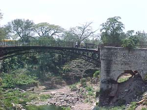
In Spanish Town an iron bridge was built in 1801 over the Rio Cobre at a cost of about £4,000. It is the oldest of its type in the western hemisphere, and is today only used by cyclists and pedestrians.
During the anticipated French invasion of 1805, all the public records of Jamaica were deposited in the Parish Church of St. Thomas-ye-Vale in Bog
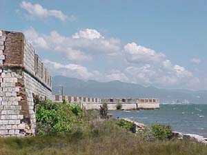
The British guarded the coastline of the parish from Kingston Harbour through Hellshire with several forts: Fort Henderson, Fort Augusta, The Apostles Battery, Rodney’s Lookout, Fort Clarence, Fort Johnson, Fort Small and the Deanery.
After Emancipation in 1834, the former slaves established free villages in the St. Catherine hills with the assistance of Baptist Missionaries, the first being at Sligoville in 1835 named after the governor, the Marquis of Sligo. Another was located at Kitson Town in St. Catherine.
In 1866, the number of civil parishes was reduced from 22 to 14, and the parish of St. Catherine as we know it today is the result of the merging of four smaller parishes: St. Thomas ye Vale, St. John, St. Dorothy and the original St. Catherine (see Figure 2).
The capitals of each of these parishes were Guanaboa Vale, Bog Walk, Old Harbour and Spanish Town.
Sir Charles Price transformed the plains of lower St. Catherine into fertile lands by laying down the Rio Cobre irrigation canals in 1875. Sugar plantations at Bernard Lodge, Innswood and Caymanas located there as well as Worthy Park and others in the uplands, underscored the importance of sugar to the economy of the parish
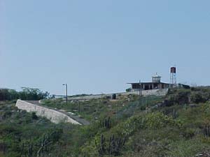
Port Henderson, now a fishing village, was an important resort for a “change of air” from Spanish Town. A mineral spring was located there, and buildings on the slopes of the Healthshire Hills (now called the Hellshire Hills) afforded comfortable accommodation for visitors. Near the end of the nineteenth century, a temporary Marine/Zoology laboratory was operated there by the John’s Hopkins University, Baltimore, Maryland, USA. At Green Bay nearby is the old Quarantine Station, now used as a firing range by Jamaica’s military. On the Healthshire Hills is Rodney’s Lookout, from which the Admiral watched over the adjacent sea for the invading French Fleet, which he finally defeated in 1782. To the east is Fort Augusta built about 1850 as a military station where all ammunition and other combustible materials were deposited by all ships proceeding to Kingston. After falling into ruins, it was restored as a prison. To the west was Fort Clarence which was fortified as a modern fort during World War II, but has since been dismantled.
The Twentieth Century
During World War II, the United States of America established a naval air station on Little Goat Island – one of two small islands off the Old Harbour Bay Coast – to provide base facilities for two squadrons of seaplanes whose mission was to patrol the approaches to the Caribbean (and therefore the Panama Canal) via the Windward Passage (between Cuba and Haiti). Commissioned in 1942, it was equipped with two timber piers, a concrete seaplane ramp, a parking area and various buildings, including quarters for 75 men and 25 officers, two administration buildings, a ten-bed dispensary, a power plant, a shop, utility buildings and a warehouse. Fresh water was brought in by barge from the mainland, and pumped from the dock to storage tanks for treatment and distribution. A total of 2.8 million cubic yards of dredging was conducted to remove shoals from the seaplane runway and to deepen the anchorages and channel approaches to the piers. Gasolene storage totaling 75,000 gallons was provided in eleven underground steel tanks. The base was decommissioned in 1949.
The first Rastafarian settlement in Jamaica was at Pinnacle in St. Catherine (near to Sligoville). Leonard P. Howell, one of the founders of the sect which believes that Ras Tafari – Haile Selassie I of Ethiopia – is the living God, bought that abandoned property in May 1940 on behalf of the “Ethiopian Salvation Society”, and lived there with over 1,600 followers from Kingston and Port Morant. They burnt coal and lime, and cultivated sections of the property, which was quite large. They were constantly harassed by the police for growing marijuana (Cannabis sativa), and at least 28 were imprisoned for this offense. Howell proclaimed himself to be God, for which he was discredited, and after the police finally broke up the community in 1954 and arrested 163 persons, Howell was confined to a mental institution.
Although agriculture remains an important sector, large industrial plants were built to take advantage of good communications and power supplies. The Ariguanabo Textile Mills were established in 1950 to produce cheap textiles to local specifications. In 1953, a deep-water port was built to the east of the original Esquivel (Old Harbour by ALCAN to export bauxite mined at Shooters’ Hill, Manchester. ALCAN subsequently established bauxite mines and a bauxite-alumina plant at Ewarton from 1956-1959 at a cost of £15,000,000. Today, alumina from Ewarton is exported from Port Esquivel, and oil, grain and other commodities are imported. The milk condensary at Bybrook and the nearby citrus factory have created a mini-industrial park near Linstead. A major industrial park is located at Twickenham Park, where batteries, carpets, plastic bags, cigarettes, plastic pipes, waterboots, pharmaceuticals and other products are manufactured. Several industries are also concentrated near Old Harbour, Ferry, Central Village and in Spanish Town.
Future Directions
Because of its close proximity to the rapidly expanding city of Kingston, and because of the availability of large tracts of fairly flat land, much of the south-east part of the parish – including Spanish Town itself – has in the past 25 years been transformed into an extension of the Kingston Metropolitan Region. Part of this has been achieved through the establishment of large dormitory-type settlements in a region now known as Portmore, which has a population well in excess of 100,000. Much of this development took place after the reclamation of wetlands on the western edge of Kingston Harbour. Spanish Town, while it falls within the Kingston Metropolitan Region, has managed to maintain its separate identity, and is itself today an important centre of much commerce, industry and transportation.
Despite a long history of human use and occupation, the superficial appearance of the coastal landscape of Hellshire has hardly changed since Taino days, although the ecology of the inland plains has been greatly altered. Nevertheless the area is still of outstanding ecological importance, and this is why it is important to develop a strategy to ensure that it is properly managed for the long-term benefit of all. Much of the southern part of St. Catherine is incorporated into the Portland Bight Protected Area declared under the Natural Resources Conservation Act (1991) in April 1999.
(6) BLACK, Clinton V. History
